oddingebretsen
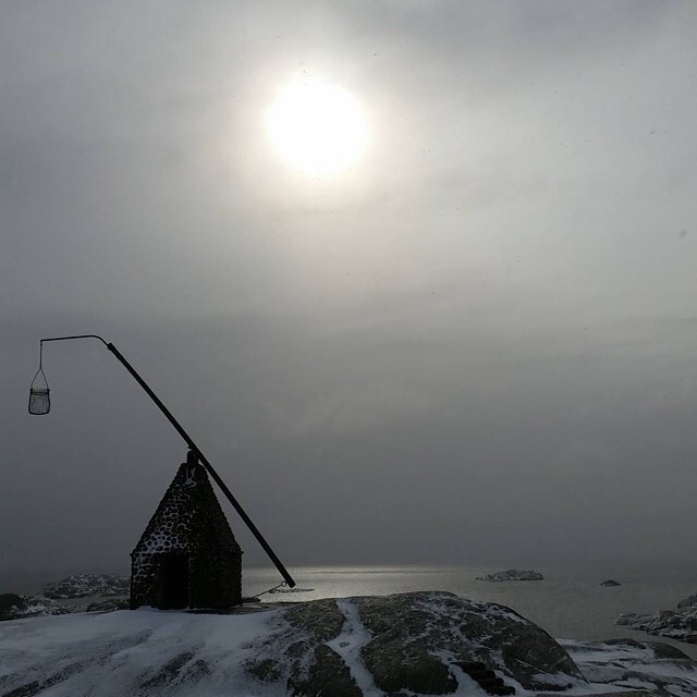
This brilliant picture is shot by oddingebretsen and published on his profile on instagram (@oddingebretsen). NorskSykling then added some words and repostet it on our own profile (@norsksykling). If you want to see more fantastic shots from oddingebretsen – just follow the button below.
If you live in the Tønsberg area you surely know this place
Verdens Ende (World’s End, or The End of the Earth). Located at the southernmost tip of the island of Tjøme in Vestfold county.
The route Tonsberg – Verdens Ende is about 25 km. Follow the fylkesveg 308, the main road through the municipalities Nøtterøy and Tjøme.
Verdens Ende – with a panoramic view of the Skagerrak. A strait running between the southeast coast of Norway, the southwest coast of Sweden, and the Jutland peninsula of Denmark, connecting the North Sea and the Kattegat sea area, which leads to the Baltic Sea.
It has a replica of a Vippefyr, an early type of beacon or lighthouse, erected in 1932 (in the picture).
Flytsti
It´s also possible to ride the stretch by trail. If interested, we recommend contacting a group of local enthusiasts named Flytsti (@flytsti). They will help you out.
In the summer months this number rises to around 40,000
Tjøme municipality is completely located on islands. There are approximately 4,600 permanent residents here, but in the summer months this number rises to around 40,000 inhabitants, including the Norwegian Royal Family who have a summer house here. Tourists mostly from the Oslo area.
Challenge Norway
If you love to swim and run as well? Sign up for the Challenge Norway.
Will be arranged for the first time August 27, 2016.
1.9 km swim – 90 km bike – 21 km run.
The bike-route has a turnover point on World’s End.
Sounds perfect? Check out @challengenorway or challengenorway.no
